From Daniel T.V. Huntoon's
History of The Town of Canton, Massachusetts (1893)
CHAPTER VII
ROADS AND WAYS
The street now known as Washington Street begins at the Milton line, and runs to the Sharon line, near Cobb's tavern. This is our most ancient road, - the king's highway. Portions of it were in existence during the middle of the seventeenth century, as the way to Rhode Island. The northern part, where it passes Blue Hill, is mentioned in 1690, and in 1694 is called the "common road," as it passes Puffer's farm. In 1700 it was laid out by the selectmen of Dorchester three rods in width, and was called " the road leading to Billings'," meaning the tavern in Sharon, where it joined the road leading from Boston, through Dedham, to Seekonk. Thus it followed substantially the existing highway.[1] In 1707 it was called the "road leading to Rehoboth." In 1712 it was again laid out.
It was at a later date called the " country road," or the " main road leading to Rhode Island." In 1743 it was called the " Taunton road; " in 1785, the "great road from Boston to Taunton ; " in. 1799, the " main road ; " in 1800, the " great road;" again in 1830, the " Taunton road;" and in 1840 it received from the town the name of Washington Street.
This road has changed its course at various points since first laid out. It entered on the Canton line at a variation from its present course, turned to the left near the great oak opposite Cherry Tavern, then crossed the present street to the right, north of the Bussey house, and hugging the western base of the hill came into a portion of what is now Green Lodge Street. South of Ridge Hill it made a detour to the left of Jake's Pond, and went around instead of over Pine Woods Hill, the present course being adopted in 1831. At Canton Corner it bore to the right of Packeen Plain.
In 1757 James Endicott petitioned to have the way turned near his house; and the town voted to turn the way on the northeasterly side of Mr. Endicott's, at a small hill near Mr. Thomas Shepard's land, provided Endicott should give the land, and the way could be made passable. From Endicott's the road ran substantially as follows. Crossing the brook near the present site of the Kinsley Iron and Machine Company's Works, it continued to what is now High Street, when it followed that street to the present Sharon line. This part of it was at one time called "the road to Mashapog."
Returning again to Milton, at the junction of Green Street and what is called in Milton Canton Avenue, - our Washington Street, - we find on what is now Green Street an ancient road. It was laid out by Samuel Capen and James Blake, the selectmen of Dorchester, in 1704, and is accurately described as the road about Little Blue Hill. It is thus described :
"From three chestnut trees at the beginning, over Nathaniel Clap's land, which was Lot No 1, over Thomas Tolman's land, which was lot No 2 [now the Hemenway farm], on the side of the hill above the old way, to a bound tree between Thomas Tolman and Timothy Crehores land, so along Crehores land on the side of the hill, and then along below the hill on the left, where there is a convenient way to the east of Isaac Royall's lot, part of the way; and then go upon his land over a stony hill to a white oak tree, marked, and to a little further, and to go partly on Ephraim Newtons land and partly on Isaac Royalls, only by his house, not so much upon him as upon Newton, and when it comes near to the old way, more upon Royall than Newton."
Another road laid out to the west of this is described -
"to begin at Crehores land and go to the north corner of Henry Crane's land, and so to go the south east way going down the hill, then leaving the old way up the side, and then down into a valley and continue up another hill and so along further till it comes over Ponkapoag brook."
There appears to have been a road which, going in by the house of Deacon Silas Crane, now owned by Mr. Hemenway, skirted the meadow, and passing the houses at one time occupied by Peter Lyon, TomLin, and others, came out at the entrance of the present avenue now leading to the house of Colonel Wolcott, near where stood the house of Mrs. Topliff. It ran across Green Street at right angles, and came out on Wood's Lane. This road is still in existence, and can be driven over with difficulty.
It is probable that this road led-to the Sprague farm at Readville. Whether it was a public road, I am not informed. In 1729 a driftway was laid out from the Fowl meadows to the road by Mr. Thomas Vose's; and' this is probably the way marked at the Readville terminus by a lane on the upland, and a long line of willows extending into the Blue Hill meadows. There is a bridge, called in 1719 Fisher's Bridge, which was probably built by Anthony Fisher, who was a tenant on Mrs. Stoughton's farm in the seventeenth century. Nathaniel Hubbard subsequently rebuilt this bridge; but it was not thrown open to the public until 1759, when Dedham and Milton again rebuilt the bridge. It was known to persons now living, who remember it as Swan's Bridge. During" the first century of our town life communication with Dedham by teams was arduous. There were but two ways to reach Dedham by public road in the early days. One was to go through East Walpole, and cross the Neponset at the bridge, built in 1652, " near the Widow White's; " that is, near the present site of Morriil's ink factory. This spot should be remembered, for it was here, in 1675, that the two companies of Captains Henchman and Prentice halted during the eclipse of the moon, when they were on the march to the Narragansett country against King Philip. The other road to Dedham crossed the Neponset at Paul's Bridge. In 1729 a driftway was laid out from Captain Vose's to the Fowl meadows.
In 1720 a bridle-path led to the river from near the residence of the late Adam Mackintosh, called the " way to Aspinwall's," at the end of which a ford existed in 1726, near the " Long Ridge," as it was called, not far from the iron bridge on the Boston and Providence Railroad. Later a ferry was established; and travelers who desired to cross were obliged to call the boatman. In 1730 the town voted to build a bridge " over y" long ridge; " and again in 1732 substantially the same vote was passed, in order that those persons who resided in the town, on the northwest side of the Neponset, might be accommodated; and until this bridge was completed, it was voted that the inhabitants on that side of the river should be free from ministerial charges. But the river was made the line; and no bridge was built at this, the narrowest point of the Fowl meadows between the towns of Stoughton and Dedham, until 1803, and the ferry continued to be used within the memory of persons still living. The matter of building the road, now called the Dedham road, was agitated in 1792; and in 1796 an article was inserted in the warrant " to see if the town will take any measures relative to laying out a road from this town to Dedham, near Henry Crane's." The town voted to do so, and the " Long Ridge" opposite Eaton's Shore was deemed admirably adapted to the purpose.
Green Street ran in early days about as now, from Milton line to Coombs's. It was called in 1738 the road "from Milton to the creek near Jonathan Kenney's." From near Kenney's there seem to-have diverged three roads, — one turning to the right near Coombs's, and passing over the brook by a picturesque bridge, to which I shall refer later. The other two forked near the former residence of Captain Shaller ; the left-hand road passed through what is usually known as Tucker's Lane, and was the traveled road to Ponkapoag. There was also a cartway leading to Washington Street, which came out near Blackman's shop. The right-hand road led through Capt. William Shaller's farm, crossed the brook in the rear of his house by a wooden bridge, bore to the left, and crossing Pecunit Street, passed near the eastern gate of the cemetery, and went through the Catholic Cemetery. Here it appears to have been called, as it passed the house of the first minister, the Taunton Old Way. The road then led to the old house standing near the pond on Pleasant Street, in old times called Bussey's Corner. It here branched, one portion turning to the left, over Hartwell's Dam, and known as the Dorchester Swamp road, now Pleasant Street, until it reached a point near Profile Rock, when, bearing to the right, it crossed, in 1719, the farm of Edward Bailey, later owned by Franklin Reed, and entered Pine Street, where it continued by a circuitous route to Dorchester Swamp, or modern Stoughton. From Bussey's Corner a road led to the right, by the house of David Tilden, now known as Priest Howard's, and came out nearly opposite the brick house of the Endicotts, on Washington Street. This portion of the way was called, until 1727, the Taunton Old Way. In 1764 it was discontinued, and the land conveyed by the guardian of the Ponkapoag Indians to the abutters. John Billings, John Withington, Jr, and David Tilden.
It was discontinued through Morse's homestead before 1740, yet the same year John Billings bounds the southerly portion of his farm on a path formerly called the Taunton Old Way.
Coming from Milton up Washington Street between the Little and Great Blue Hill, the first street on the left is Blue Hill Street. It was mentioned at a very early period, but it does not appear to have been laid out until Sept. 23, 1726. Its width was two rods, and it was described as " under the western side of Blue Hill until it comes to Milton Line, and meets that way in Milton that lieth on the Southerly side of ye Great Blue Hill." At one time it was described as running " from Royall's Corner by Puffer's to Milton Line." Opposite, on the western side of Royall's Corner, a street was laid out, and was styled, in 1729, the road westerly from Capt. Isaac Rovall's leading toward Silas Crane's. This is the road which came out near the old Topliff house. In 1763 it was described as leading by Silas Crane's, through Dr. John Sprague's and Isaac Royall's, by the house of said Royall to the country road. Another road led directly from Royall's Corner to the house formerly occupied by Elijah Hayward at the junction of Kitchamakin and Elm streets. It can still be traced, a few rods southerly of Royall Street, and running parallel thereto.
In 1824 this road was surveyed, a plan was made by Joel Lewis, and it was called the " road leading from the Taunton road near John Davenport's to Gen. Nathan Crane's." It was widened to two rods, and 476 rods were taken from the abutters for this purpose. Edward Wood was residing in the Royall house between 1830 and 1S4O, and in the latter year this road was named by the town Wood's Lane. It was then described as running from John Davenport's to Ebenezer Crane's. In 1881 its name was changed to Royall Street.
Proceeding on Washington Street southerly, we reach, at the top of the hill, at the northerly line of the Ponkapoag Plantation, a narrow lane, which leads directly west to nearly opposite the Capt. William Shaller house, on Green Lodge Street, on which stood at least one house. Continuing through Ponkapoag Village we pass, at the foot of the hill, Green Lodge Street. This street was called Green Street from this point to the Milton line by the way of Shaller's and Eldridge's from 1840 to 1881 ; but as the portion leading over the bridge to Green Lodge, in Dedham, had been joined to it in 1852, making a straight line, it was decided to call the entire street after Green Lodge, a place known by that name as early as 1719. The committee of 1840 describe it as running from Strowbridge's to Milton by Michael Shaller's.
When we go down Green Street from Ponkapoag, we follow the track the Indian trod when he went from his wigwam to the Neponset River to fish; it was the Indian trail from Ponkapoag to the river. In 1727 the part nearest Ponkapoag was the "path that leadeth down to Elias Monk's house," which stood on the Shaller site.
In 1764 the dwellers in this vicinity petitioned the selectmen to lay out a road from the house of Jonathan Kenney, where Mr. Coombs now lives, to the country road near Thomas Crane's at Ponkapoag; but the town, deeming the price demanded for the land exorbitant, refused to accept or approve the way, whereupon the petitioners appealed to the
Court of General Sessions. It is probable that the appeal was successful, as the road was laid out and accepted a few years later.
In 1799 it was called, after the old Tory of Ponkapoag, Taylor's Lane, because the house he occupied was at its westerly termination : it is still standing", and known as "the old Tory house."
Proceeding on the main road, we come to the old Ponkapoag Hotel. The road that runs directly south is the Turnpike, and quite modern. Although from the engine-house to Farm Street it followed the old road leading to Bear Swamp, it was incorporated as the Stoughton Turnpike, June 23, 1806, and was laid out., from John Tucker's, through Stoughton, to Easton. In June, 1840, it was laid out as a public highway, and in 1856 re-located; it runs almost in a straight line to Stoughton. The cellar of the old toll-house is still to be seen on the easterly side of this road, south of what is commonly known as Capen's mill. In 1881 this street received the name of Turnpike Street.
Returning now to the Ponkapoag Hotel, we take the right-hand road, and crossing Ponkapoag Brook, see on the left a short street leading up a steep hill; it is called Sassamon Street. Should we turn up this street, we should find that it is now only a short cut to the Turnpike ; but formerly it was a portion of the road that led to the Old Colony line. This road, making a detour at the top of the hill to the right, divided near what is now Farm Street, the left-hand road going through to the farms, substantially following Farm Street, and then dividing opposite the house of Ellis Tucker. This left-hand road, leading in 1690 to Bear Swamp, is now known as the road to Randolph. In 1727 there was a petition presented for a road from the country road to that part of the town called York. In 1734 it was designated as the "road from Ponkapogg Brook through Mr. Fenno's farm to Philip Liscom's ; " sometimes as the road from Nathaniel Sumner's (who lived near Ponkapoag Brook) to York; later it is described as " beginning at John Liscom's fence near Thomas Jordan's house, at a rock at ye ascent of ye hill near Benjamin Jordan's old cellar, over ye brook where ye bridge is now made, through Mr. Fenno's farm, between Deacon Joseph Topliff and Nathaniel Sumner, to the road."
On the top of the hill near the house now occupied by Jefferson May, the road turned to the right, and passing through the land owned in 1760 by Paul Wentworth, crossed York Brook about a quarter of a mile north of where it does at present. There stood a saw-mill. The road then joined the Indian Lane at the top of the hill near the Bancroft cellar-hole. In 1772 it is laid out, " as by Aaron Blakes over York Saw Mill pond." This was a very ancient road, and continued on by York Pond to East Stoughton. It was known in 1664 as Pigwackett.
The right-hand road is now called York Street. An ancient map in the possession of Mr. Jesse Fenno, dated 1742, calls this street the "road to York;" it ran in 1840 " from Lemuel Tucker's to the Stoughton Line."
Let us now return to the junction of the Turnpike and Farm Street, and take the Turnpike, and we shall have some difficulty in determining exactly the ancient roadways. One appears to have followed substantially the route of the Turnpike for a short distance, and then to have led straight to Belcher's Corner. This ancient highway must have been the most direct way from Ponkapoag to Taunton. Mr. Jabez Talbot, who died in Stoughton in 1881, said that he could remember " when stages went over that route."
The territory traversed by this road is unoccupied except by a few houses that stand close to the highway. One can wander for hours together over these forsaken acres without finding any trace of habitation. A roadway from the house of Mr. Horace Guild crosses the land ; and there is no spot in Canton more delightful to visit on a pleasant day. The road is rough, to be sure, as it is only used for the purpose of carting wood, but these wood-roads furnish cool and shady drives or walks; and diverging from them are smaller paths, where one treads on moss of the finest verdure, or sits on banks covered with ferns and flowers. Along these secluded paths the botanist can, in their season, find rare plants, which will well repay him. for a visit to the place. Hills and valleys break the monotony of the landscape, and at intervals one obtains fine views of the surrounding country. A thick growth of wood covers a large portion of the land, and the remainder consists of fields which have long since ceased to be cultivated. Here was the clay-pit, from which the farmers carted clay; and the rocks' along the roadway are worn by the heavy iron straps that covered the wheels of their primitive wagons. Here, also, was an Indian burial-ground. The location is ascertainable, but there is no visible sign of mounds. A thick growth of wood covers the ground, and vigorous digging for the relics of the lost tribe in several places was useless. The whole territory is divided by loose and dilapidated stone wails, which serve to point out its ancient boundaries. The large farms have in later years been converted into wood-lots, owned by persons whose only interest in them is the value of the growing wood. But to those who love to recall the history of the early days when our little town was first settled, this deserted land has an interest far deeper than that which pertains to its commercial value. As we wander over its broad acres, or plod through its dark groves of pine, we discover cellar-holes half filled with rubbish and the remains of orchards, long since past bearing.
Who were the people that once lived here? Where are the houses, the cellars of which alone are left to testify to their former occupancy? Who gathered the apples from these broken rows of apple-trees? It is sad to know that the men who selected and purchased these farms have left no descendants living upon the land which, by a hand-to-hand fight with Nature, they redeemed. Some of their descendants may have occupied their ancestral houses for a few years. Now all are gone, the houses have been destroyed, and the land is desolate.
Again we return to Ponkapoag, and turning toward Canton Corner, cross Aunt Katy's Brook, where the road was widened in 1824, and pass the Blackman blacksmith's shop, where one of the branches of the road through Captain Tucker's Lane came out. Farther on we pass Ridge Hill, and on our right is Pecunit Street. Halfway up the Meeting-House Hill we cross the Taunton Old Way, and are now at the beginning of Pleasant Street. This street, from Washington Street to Reservoir Pond, was not laid out until 1723; it is described as running "from the northerly end of the dam still standing on Pequit brook, then called Hartwell's dam, on the east side of the old fence that stood between the land of John Wentworth and Jabez Searle," thence to Washington Street. This road connected at what in 1760 was known as Bussey's Corner with the road to Dorchester Swamp. From this point in very early days a cart-path, marked by blazed trees, meandered alternately on both sides of this present street. It was used to bring timber and shingles from the swamps in Stoughton to the landing-place at Milton. It appears on Butcher's map, dated 1698, but may have been drawn in later. This is undoubtedly the road described by Judge Sewall in his diary, when under date of Sept. 24, 1709, he writes that he leaves "Morey's at Ponkapog and goes over the new road," and rides over fourteen miles without see-ing a house. This early way, I believe, led to Stoughton through Pine Street, and was known in 1730 as the way to Nathaniel Stearns's.
In 1733 it is described as leading from the Dorchester Swamp road near Edward Bailey's barn to John Withington's one of the branches of the road through Captain Tucker's Lane came out. Farther on we pass Ridge Hill, and on our right is Pecunit Street. Halfway up the Meeting-House Hill we cross the Taunton Old Way, and are now at the beginning of Pleasant Street. This street, from Washington Street to Reservoir Pond, was not laid out until 1723; it is described as running "from the northerly end of the dam still standing on Pequit brook, then called Hartwell's dam, on the east side of the old fence that stood between the land of John Wentworth and Jabez Searle," thence to Washington Street. This road connected at what in 1760 was known as Bussey's Corner with the road to Dorchester Swamp. From this point in very early days a cart-path, marked by blazed trees, meandered alternately on both sides of this present street. It was used to bring timber and shingles from the swamps in Stoughton to the landing-place at Milton. It appears on Butcher's map, dated 1698, but may have been drawn in later. This is undoubtedly the road described by Judge Sewall in his diary, when under date of Sept. 24, 1709, he writes that he leaves "Morey's at Ponkapog and goes over the new road," and rides over fourteen miles without seeing a house. This early way, I believe, led to Stoughton through Pine Street, and was known in 1730 as the way to Nathaniel Stearns's.
In 1733 it is described as leading from the Dorchester Swamp road near Edward Bailey's barn to John Withington's mill-dam, now French and Ward's.
In 1719-20, a road was' laid out from the "road leading to Billings' [Washington Street], to Stoughton," and was [called the " road to Dorchester Swamp." The route of this road appears to have followed in Canton the old road, said to have run about as Pleasant Street now does to Stoughton line.
In 1745 it was laid out by the selectmen of Stoughton, then passing through a small corner of Edward Bailey's land; it is described as early as 1740 as the "road from May's Corner."[2]
In 1798 it was the road leading to Withington's Corner. From its tortuous and irregular windings, and shabby, desolate houses, it acquired, a century ago, the nickname of Ragged Row. The map of 1830 calls it the " Stoughton road."
Let us now return to the old road, which crosses Ponkapoag Brook back of the house of Mr. Coombs, by a picturesque stone bridge. This road was an ancient one, but was not laid out by the selectmen until 1738, and was described as running " from ye brook near Jonathan Kenney's to William Billings', and for the use and benefit of the proprietors of the Twelve Division Lots." In 1745 it is described as " passing through land of Jonathan Kennv, where there was a gate, then by his house, through the lands of John Holbrook, Elihu Crane, and Joseph Aspinwall, then by yc frog pond, then upon land of Thomas Spur, Preserved Lyon, Henry Crane, until it comes to Pecunit brook, thence through Dunbar's land by Stephen Billings fence, as the way is now improved, till it comes to a big rock on the hill in William Billings land." The road at this point divided, one portion going through William Billings's land, across the Wheeler farm, through what is now George F. Sumner's estate, crossed Chapman Street, and then going through Endicott's land turned and went through Wattles's Grove straight across the railroad not far from the present bridge, and so to " ye old forge," or in later days Everton's mill, now the Stone Factory Village.
The old portion of this road, which went from the ancient stone bridge to Henry Bailey's, was discontinued in 1798; and it would appear that Gen. Nathan Crane laid claim to the ancient road on account of labor performed on the new. The town did not convey the disused road, but allowed him to erect two gates upon it, one in the middle of a brook, so that there may be water on each side. Bailey also erected a gate upon it, near his house. In 1799 the Packeen road is described as the new way between Capt. George Jordan's and Colonel Crane's.
The portion of this road which was divided near the hill by Captain Billings came out at Canton Corner through Wheeler's Lane, following what is now called the Dedham road. In 1728 it was described, and two years later laid out, as the road from Capt. John Vose's by William Billings's. to Richard Bailey's. In 1760 the town was asked to confirm a road by John Wentworth, Jr.'s Corner, where James T. Sumner lately resided, to Capt. John Billings's, by William Wheeler's, to or near the country road at the Milton line.
This road also forked after crossing Pecunit Street, a few rods north of the Packeen road. One branch divided near the old Spurr homestead, crossed Pecunit Brook a little farther to the northward than the Packeen road, and skirting Pecunit meadows, came out through the land now owned by the heirs of Samuel Capen, about opposite the old Town-House. The old house now standing at Canton Corner, owned bv Abel Everett's heirs, once stood on this road, and the cellar-hole on the borders of the meadow can still be seen.
It is related that this house was built by John Wentworth, Jr., for his daughter Mercy, who married Lemuel Stodder, so that she should not be too near him. Her husband died June 24, 1789, aged ninety-five. After his death she bought in 1791 an acre of land of Dr. Crosman, and moved the house to where it now stands. A part of the old Wheeler house was added ; and a shop of one Gill was removed from Pleasant Street and attached to the other side.
The right-hand road from the Spurr homestead crossed Pecunit Brook and joined the road leading to William Billings's from Henry Bailey's and Enos Crane's homesteads.
Two ancient roads now discontinued have given place to the present Pecunit Street. In 1799 it was known as the road by Benjamin Lewis's; in 1814 as the road from Henry Bailey's to Jabez Cobb's.
Another road in 1768, probably forming a part of what is now Pecunit Street, left the homestead of Thomas Spurr, turned toward the east through land of Elijah Spurr and Zebediah Wentworth, and came out nearly halfway up " ye south side of Ridge Hill."
The road now known as Chapman Street, running from Robert Draper's brick mill to the Revere schoolhouse, was formerly called " ye way to ye old Forge." It was laid out in 1729 "from the parting of the ways westward of Mr. John Vose's, leading by Mr. Goodwin's, and so along to ye southwest side of ye river by ye old forge." In 1733 the way between the land of Rev. Samuel Dunbar and Dr. Pope was turned, and was known as Dunbar's Lane. In 1773 an article was inserted in the town warrant to see if the town would open a highway from Capt. John Billings's Corner to Everen-don's Bridge, two and one half rods wide. In 1812 it was probably laid out as it now is, and was called the road from "Wheatley's Factory to Stone's Corner."
The lane, now called Spring Lane, which leads to the Dunbar farm, was laid out in 1791, and was called Fisher's Lane.
The way leading from the Stone Factory Village to Washington Street under the viaduct was called in 1786 Billings's Lane, after William Billings, 2d; in 1790 "ye road from ye-schoolhouse on Taunton road to ye old forge." In 1824 it was surveyed and widened.
The road now known as Randolph Street, from the corner to Farm Street, may have been laid out in answer to a petition from the inhabitants in York in 1727. It appears as Fenno's road in 1754. Ten years later it runs from Fenno's causeway to the country road near ye old School House," and mention is then made of its following "ye old trodden way."
To the left of Washington Street just south of the Crane schoolhouse, is a street now known as Bolivar. It took its name from the Bolivar Works, which stood on the spot now occupied by the shovel-works. These, in turn, took their name from Bolivar, President of Colombia. It was not opened to the public until 1792, when it was laid out to " Mashapog" Brook and a bridge built; thence it ran to what was called " ye old nursery," over Crane's Dam to Beaver Brook, until it came to a lane which led from Pine Street to Eliakim Pitcher's house. In 1827 the road was surveyed and widened., from Messinger's factory to Bailey Withington's.
Walpole Street was in 1733 the road leading from "y bridge by ye old forge," through land of Timothy Jones, Joseph Hartwell, Jonathan Jordan, to Samuel Comings ; and the same year Hartwell and Jones desire liberty "to hang gates for passengers to open and shut as they pass on said way, for their recompense for damages they sustained by laying out said way." It is probable that the town did not grant this request, for the following year Timothy Jones sued the town for laying a way through his land, and recovered damages. In 1742 it was a portion of the road laid out from "ye country road near ye Roebuck Tavern to ye forge or Ebenezer Jones&Co." In 1756 Joseph Hartwell was allowed to put up two gates across the road leading from Everendon's mill. In 1840 it was designated as "the road leading from the Stone Factory by Thomas Kollick's to the Sharon line." From this road, before reaching the Walpole line, there is on the map of 1831 a well-defined outline of a road over Major's Island, laid out in 1798. It is described as running from the land of William Fisher in Pigeon Swamp to Rhode Island in said swamp, thence to Squire Sumner's upland.
In old times a bridle-way led from Washington Street across the Massapoag Brook to Frog Island. It was laid out by the selectmen in 1768, from the house of John Pierce, which stood near the former residence of Arthur C. Kollock, and passing through the lowland or clay meadow near Mr. Enos's, which he had purchased from Preserved Tucker in 1731, crossed the land of Benjamin Smith, and came to the road now known as Pine Street, near the house of Ephraim Smith.
There were a number of bridges across the Neponset, principally private, for the transporting of hay. The town was asked to repair Woodward's Bridge, which crossed the Neponset in the common field meadows, " in order that our Dedham neighbors might get their hay with less inconvenience." It is needless to record the answer to such a petition. Above this bridge was Fisher's, or Little Island Bridge, while below at the time of our incorporation were bridges bearing the names of Thayer, Holmes, Horse-shoe, and Swan. In later days Thorp's Bridge is mentioned. In 1744 the bridges at Deacon Joseph Tucker's saw-mill at "ye old forge" were rebuilt.".
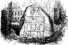
OLD MILESTONE
1 See Appendix V.
2 See Appendix IX.
Back to the main page of www.StoughtonHistory.com